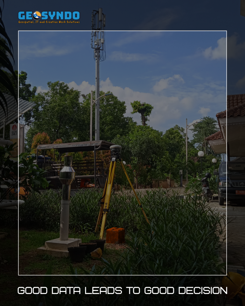
The highest quality, most accurate & precise land surveying services.
Introducing GEOSYNDO
Who we are
Starting from a discussion to collaborate, PT. Geosys Teknologi Indonesia was born on August 17, 2020 to provide Geospatial, IT and Creative Work service solutions. This spirit of collaboration is based on the fact that no single organization can run independently, it is better to collaborate than to compete.
Geosys Teknologi Indonesia is all ready to provide the best solutions to problems of Geospatial, Information Technology and Creative Works for all people in all corners of Indonesia.
All of our solutions are safe and scalable, meaning that we provide solutions that prioritize client priorities and needs, so that the solutions provided can be easily developed if needed.
Survey dan Pemetaan
Survei adalah kegiatan pengukuran dalam pemetaan Bumi, berdasarkan ruang lingkupnya dapat digolongkan menjadi:
Survei Terestris, yaitu Pengukuran dengan pengambilan data dengan cara melakukan survei lapangan untuk mendapatkan hasil titik-titik pengukuran lapangan berupa X,Y, dan Z, dimana hasilnya nanti dibentuk kontur dan data topografi lainnya.
Survei Hidrografi, yaitu pemetaan pesisir dan pantai atau mendefinisikan garis pantai dan kedalaman lautan, danau, sungai , waduk , dan badan air lainnya.
Survei Geodetik, yaitu survey Ground Control Point (GCP)Pada dasarnya penentuan posisi berbasis satelit adalah pengukuran jarak receiver GNSS terhadapa satelit Geodetik. Posisi satelit sudah diketahui sehingga posisi yang akan diukur akan relatif terhadap posisi satelit.
Our ClienTS
GOVERNMENT
Previous
Next
PRIVATE SECTOR
Previous
Next
OUR OFFICIAL PARTNERS
Previous
Next
TIME TO GET STARTED
We building everything that you needed
Give us a call or drop by anytime, we endeavour to answer all enquiries within 24 hours on business days. We will be happy to answer your questions.